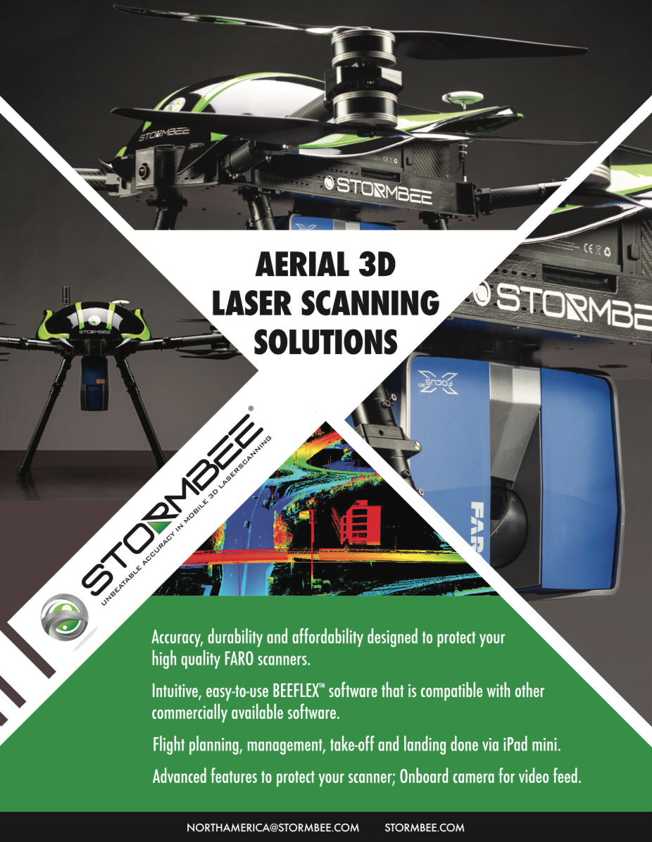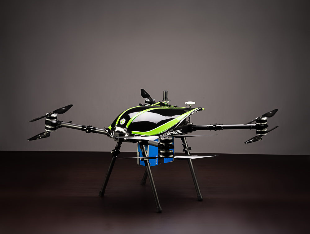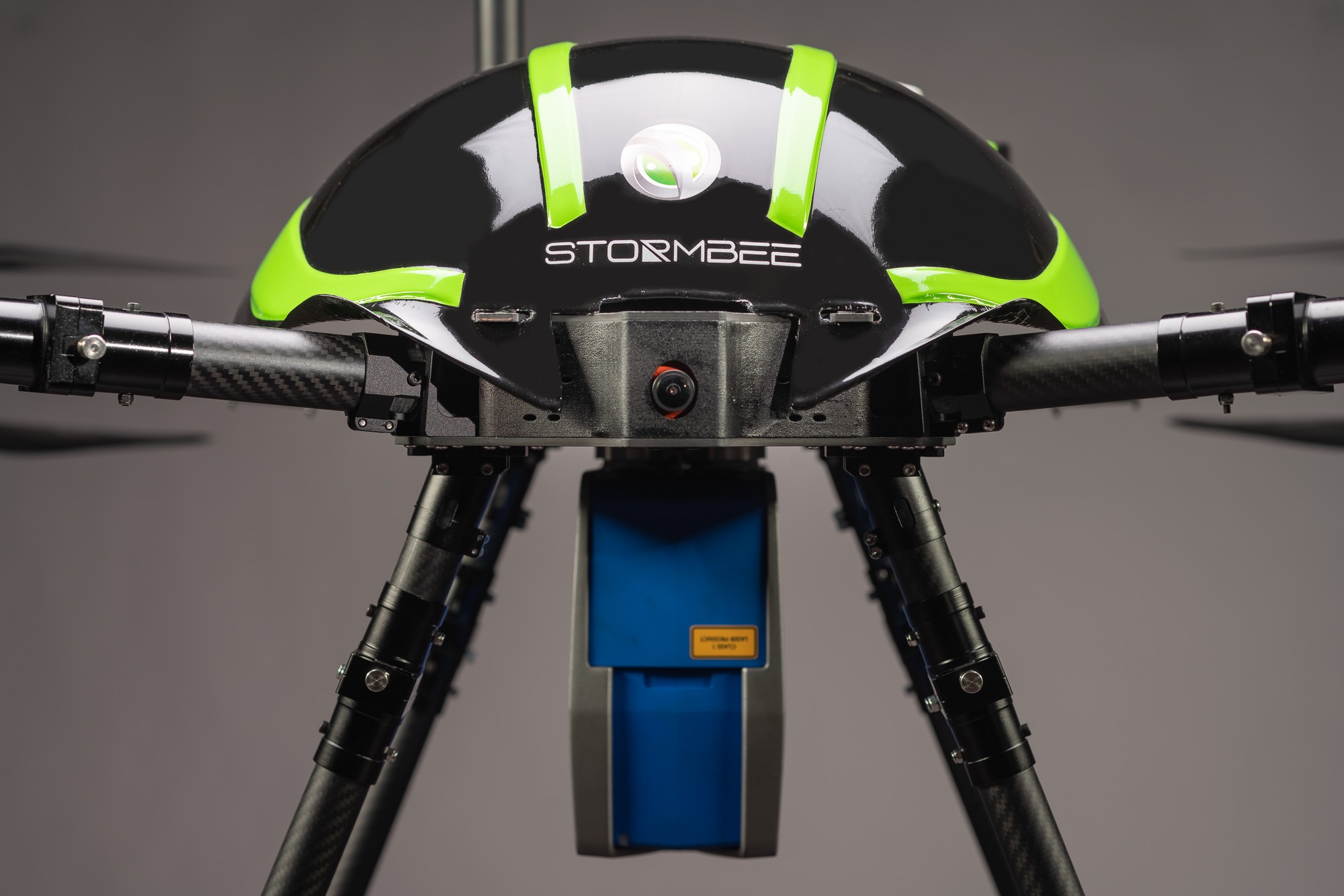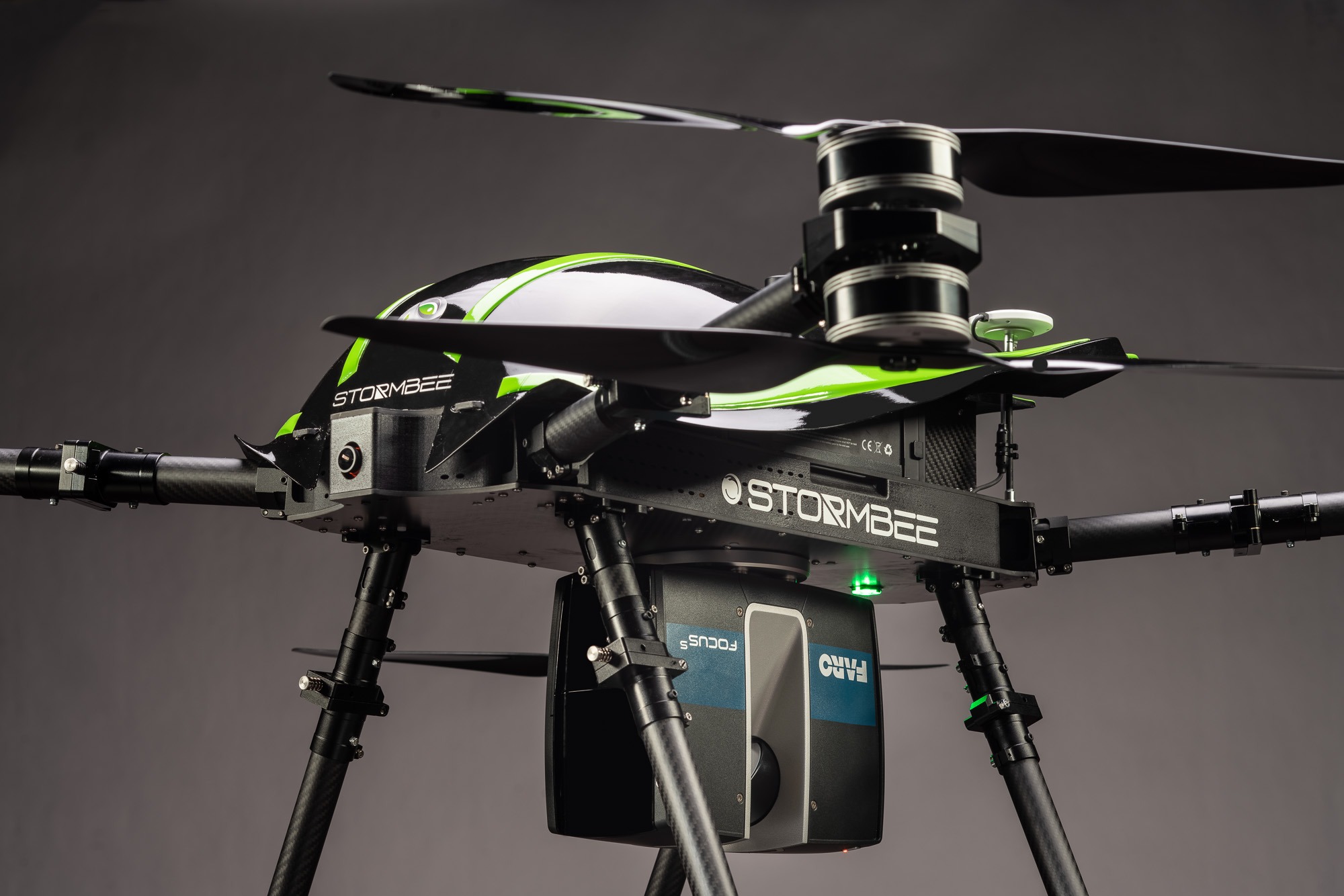
Aerial Mapping System STORMBEE
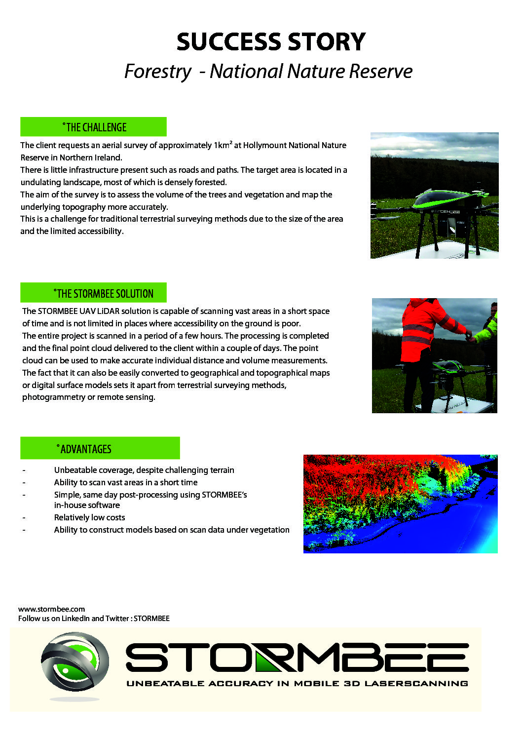
STORMBEE UAV-20 is used for aerial surveys of industrial facilities, storage areas, forestry and agricultural land and the other spaces difficult to reach in a road vehicle. STORMBEE UAV-20 has a light carbon fiber frame and can be equipped with any FARO 3D laser scanner.
Stormbee UAV
- Dimensions: 145 cm x 150 cm x 60 cm
- Size for transport: 70 cm x 60 cm x 40 cm
- Weight: 15 kg (excluding scanner)
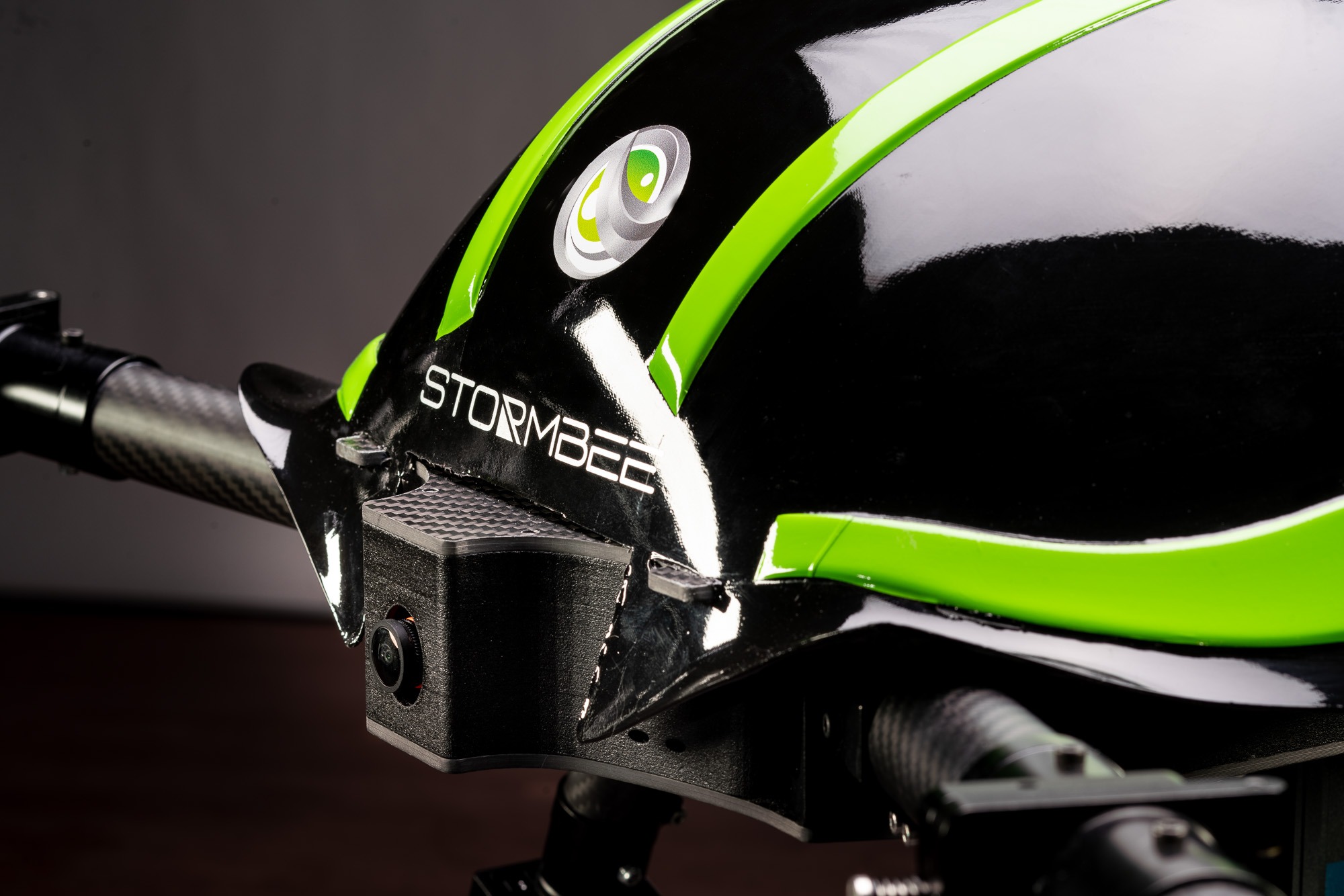
- Fully automatic takeoff, flight trajectory, and landing via iPad control station.
- Flight time: 15 minutes
- Flight Speed: 0 to 15 m/s
- Altitude: 10 to 100 m
- Wind resistance: 30km/hr
- Operating environment temperature: -5°C / 45°C
- Full carbon fiber frame with foldable motor arms
- Vertical field of view: 300°
- Absolute point cloud accuracy @ 30m: 5 cm
- Relative accuracy: 1-2 cm
- Export formats: LAS, E57
- Compatible with any Faro terrestrial laser scanner
- Measurement range dependent on Faro scanner option
- Built-in power supply for Faro scanner
- Included software: flight planning, GNSS post-processing, and point cloud reconstruction
- GNSS base station can be used optionally for best results at remote locations
Technical Information